


Ordesa Canyon


Key information: Ordesa Canyon 
- The Ordesa Canyon is walkers' heaven and undoubtedly one of the Pyrenees' finest walking areas, an extraordinarily deep and dramatic glacial gouge in the prevailing limestone. Huge cliffs, gloriously rich and varied forests.
- This walk is in high, remote mountains. Come prepared.
Walkopedia rating
- Walkopedia rating90
- Beauty34
- Natural interest17
- Human interest2
- Charisma37
- Negative points0
- Total rating90
Vital Statistics
- Length: Variable
- Maximum Altitude: 2,767m
- Level of Difficulty: Variable

WALK SUMMARY
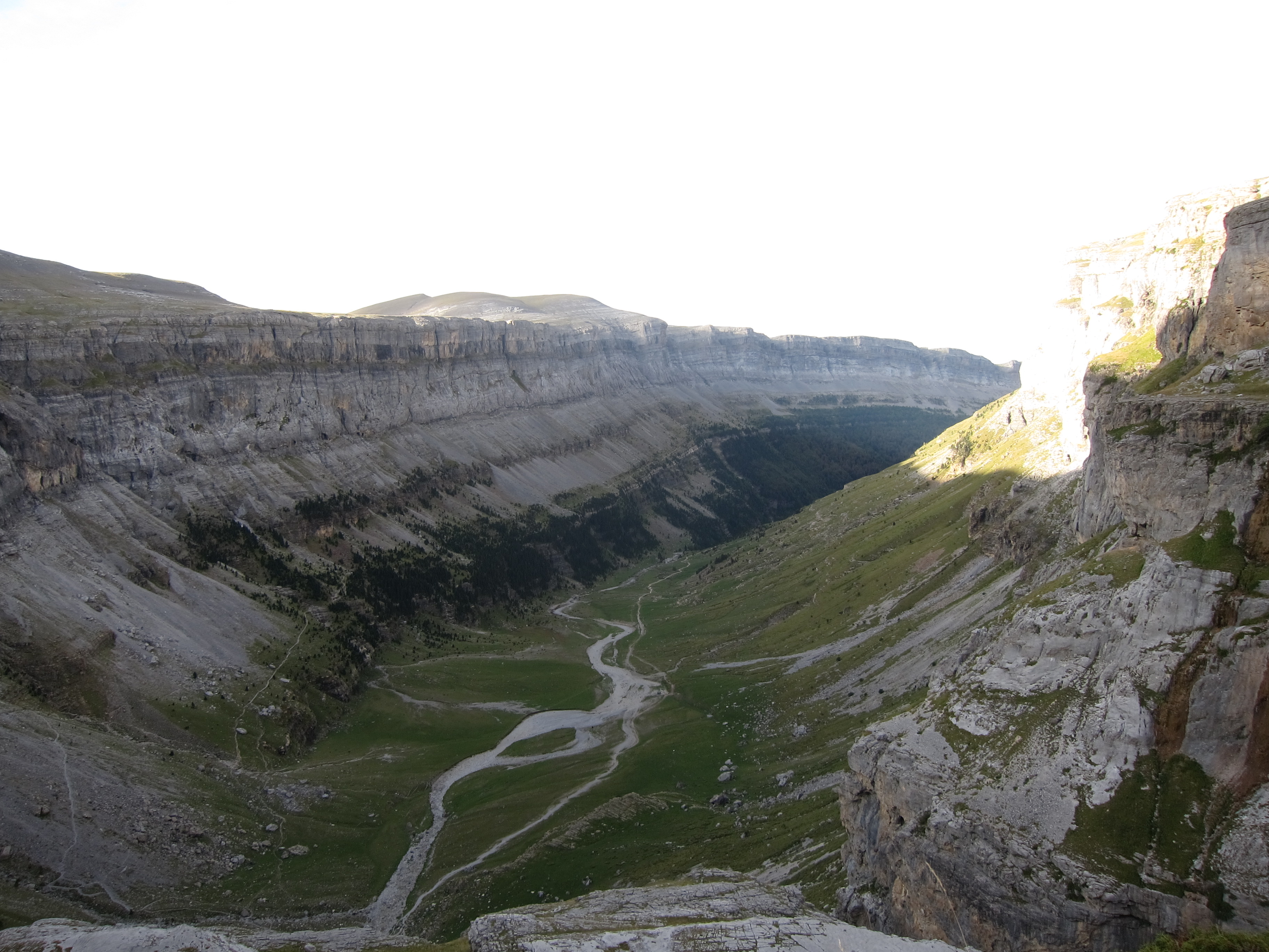
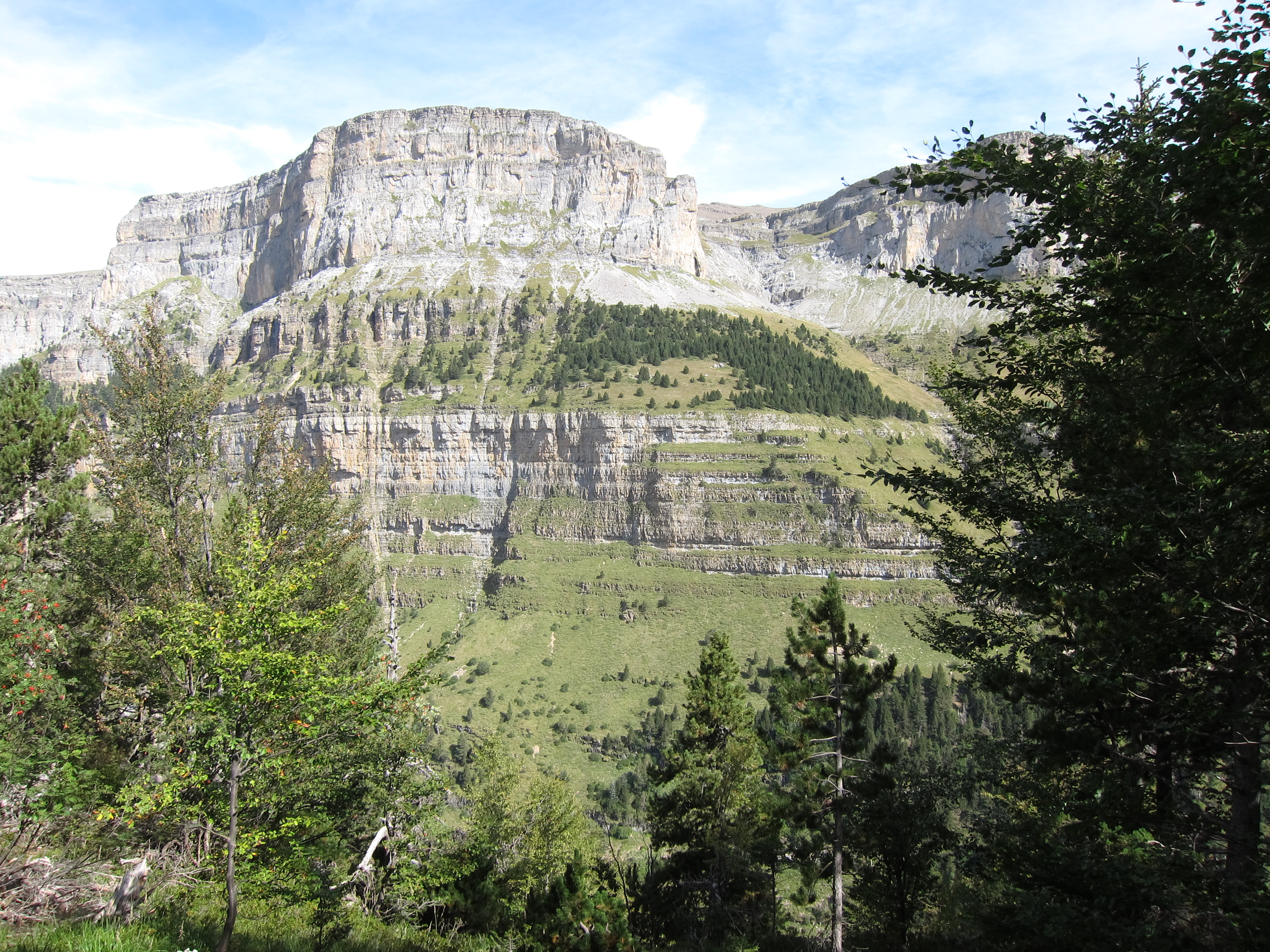
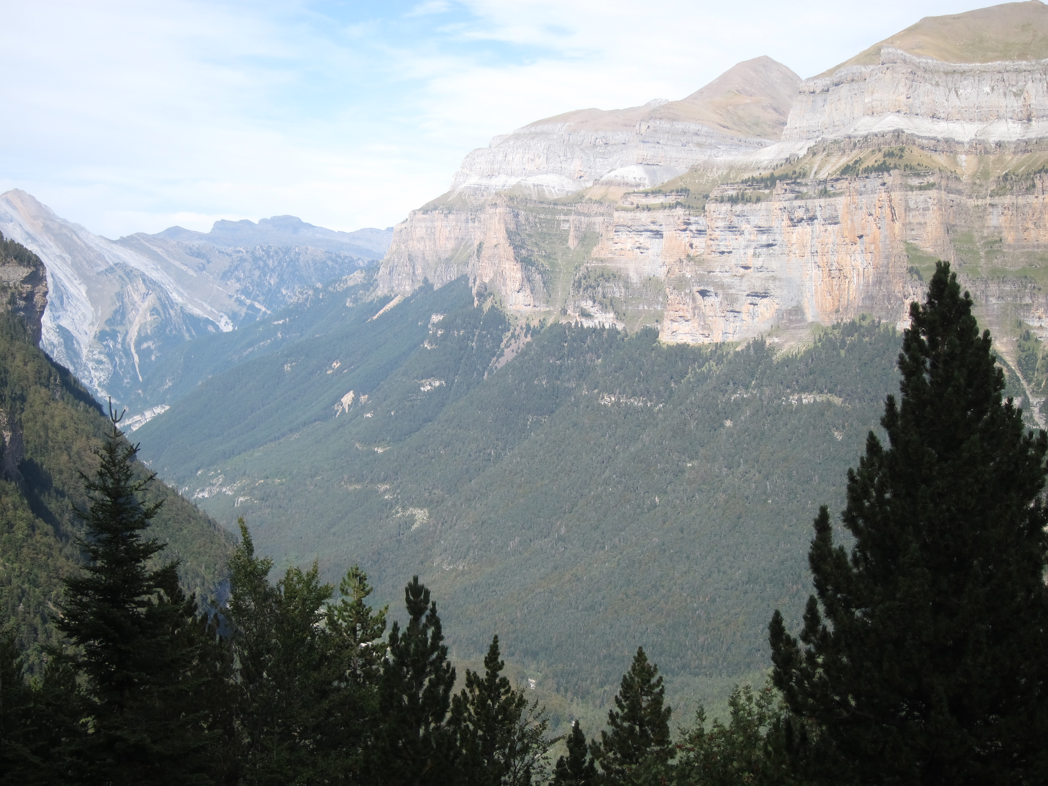
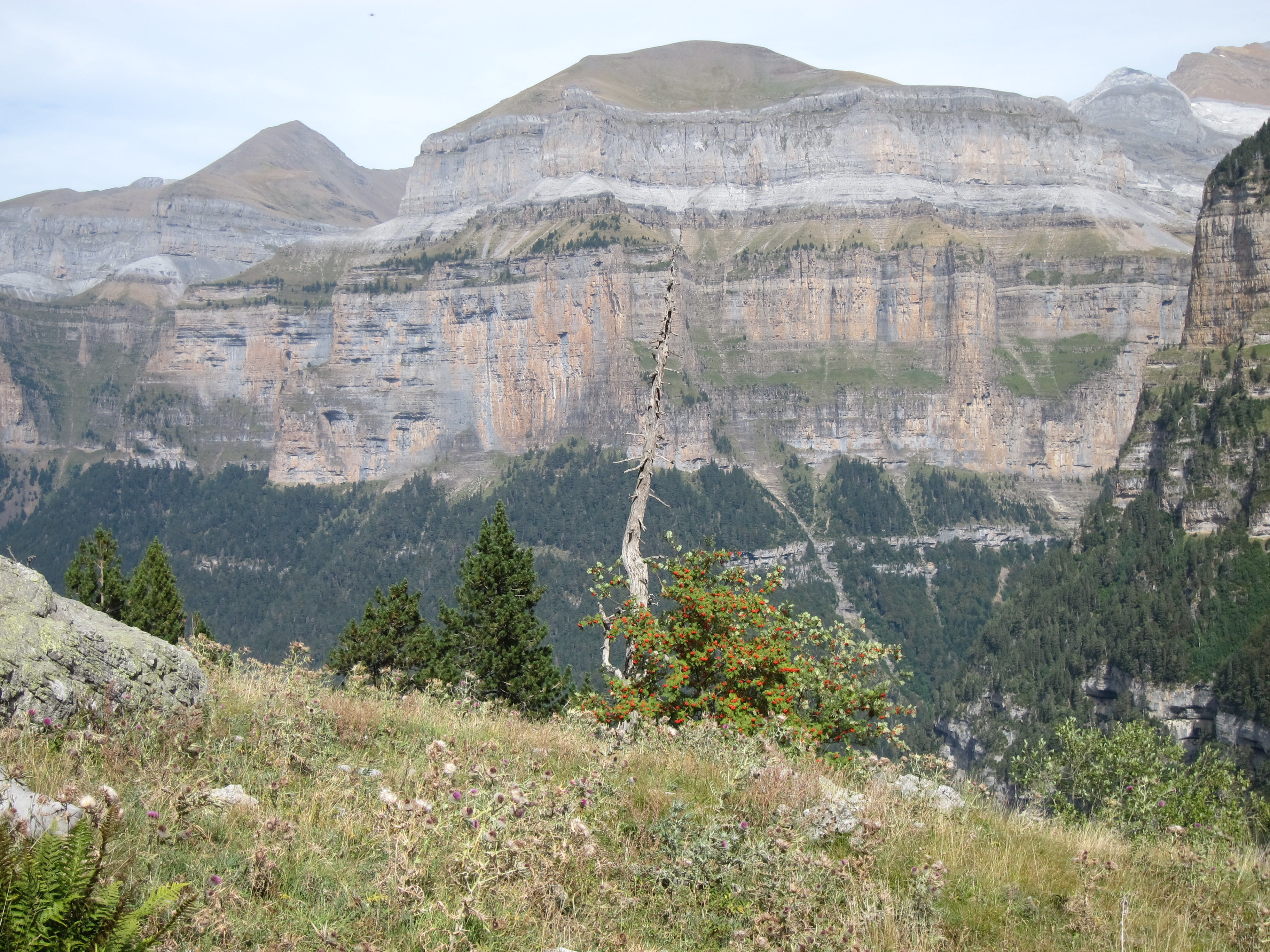
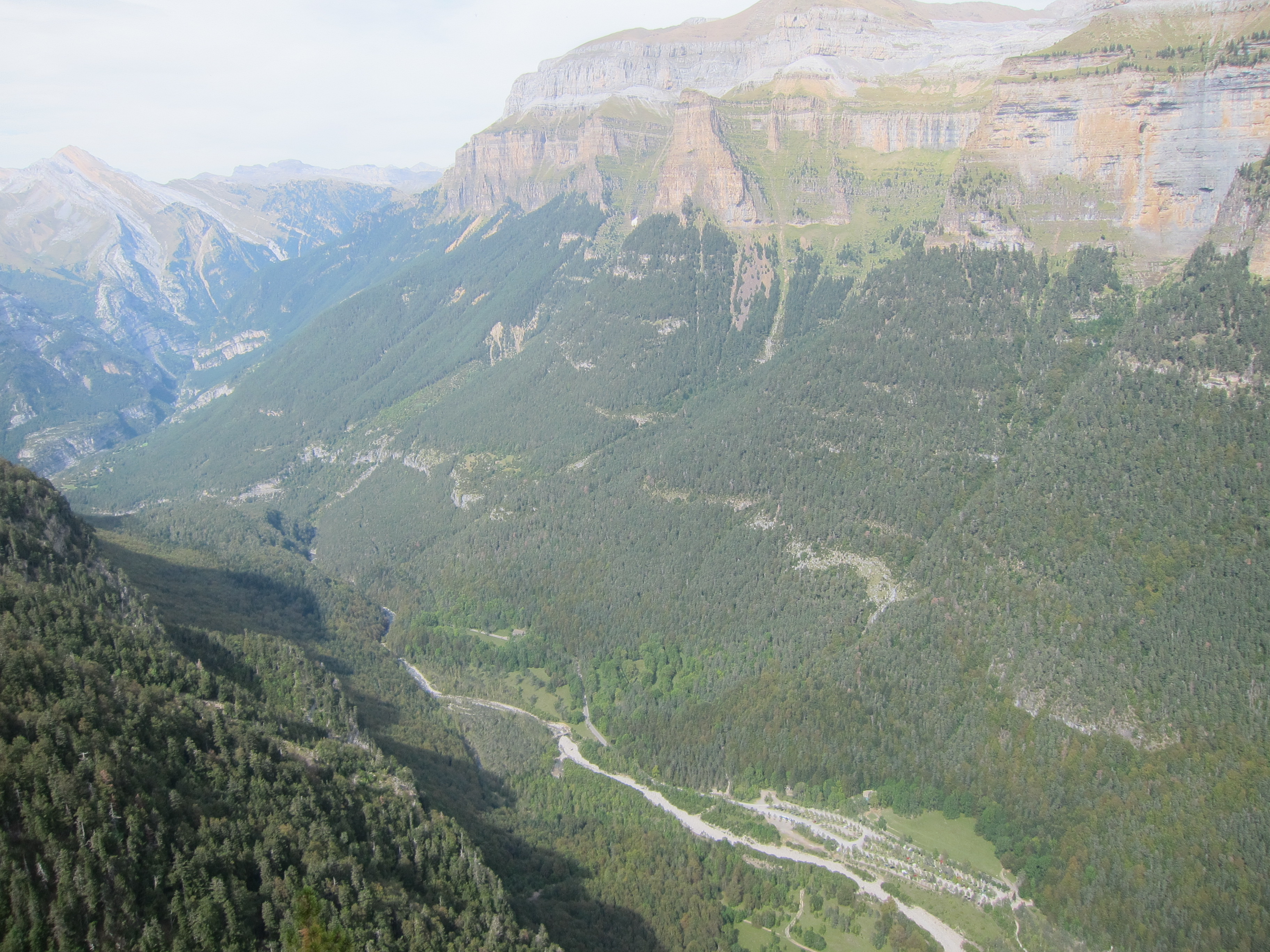
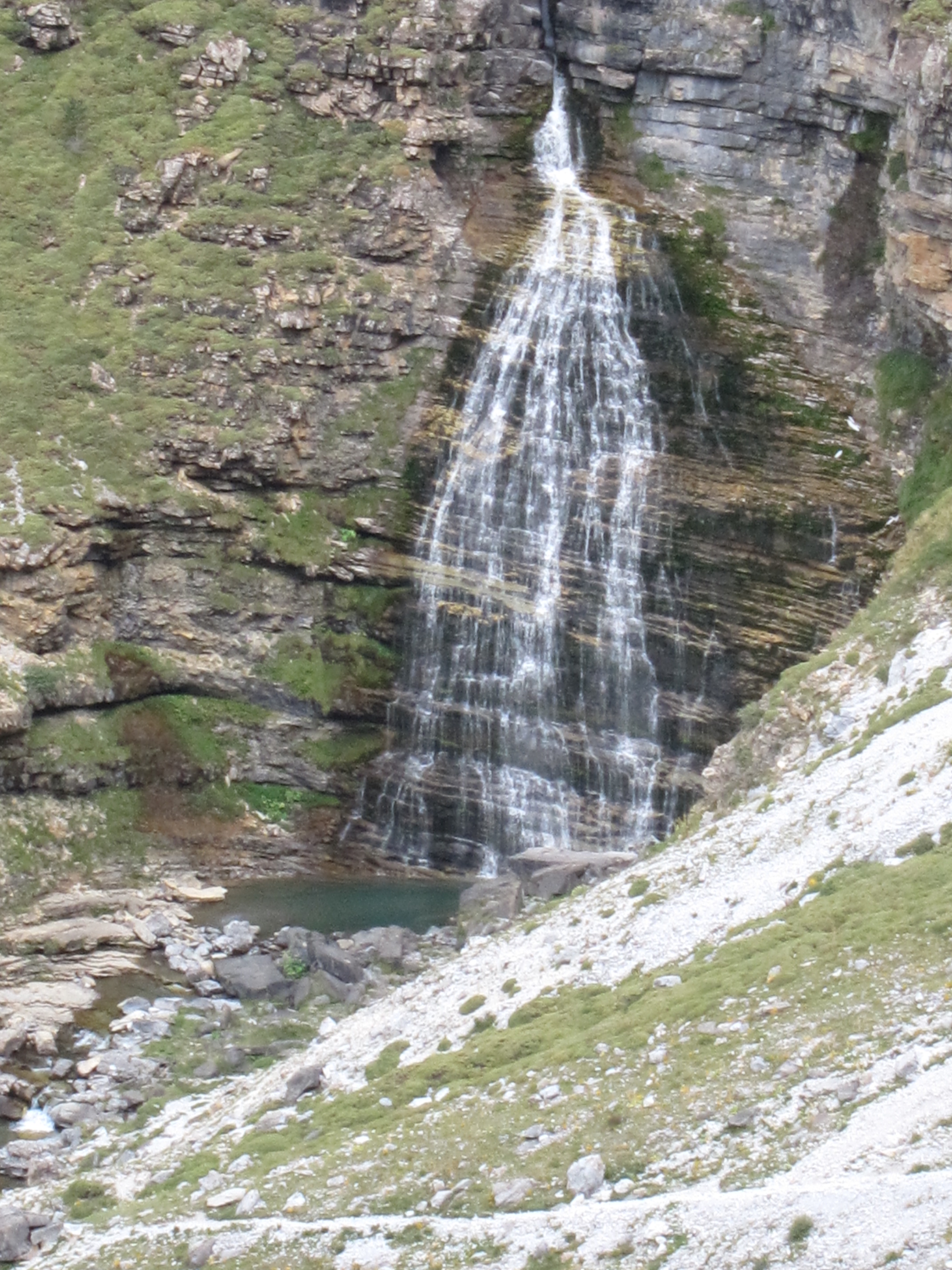
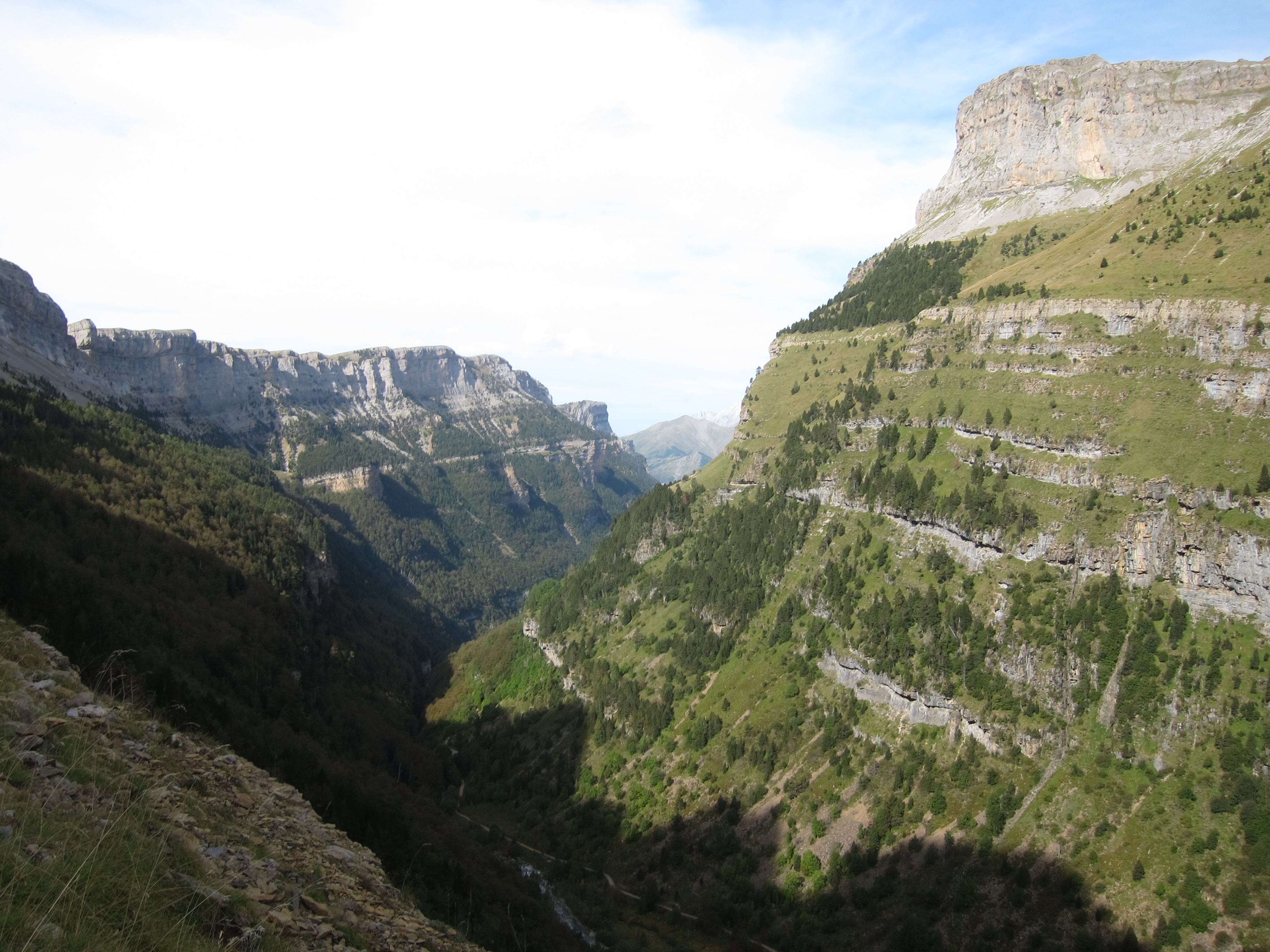
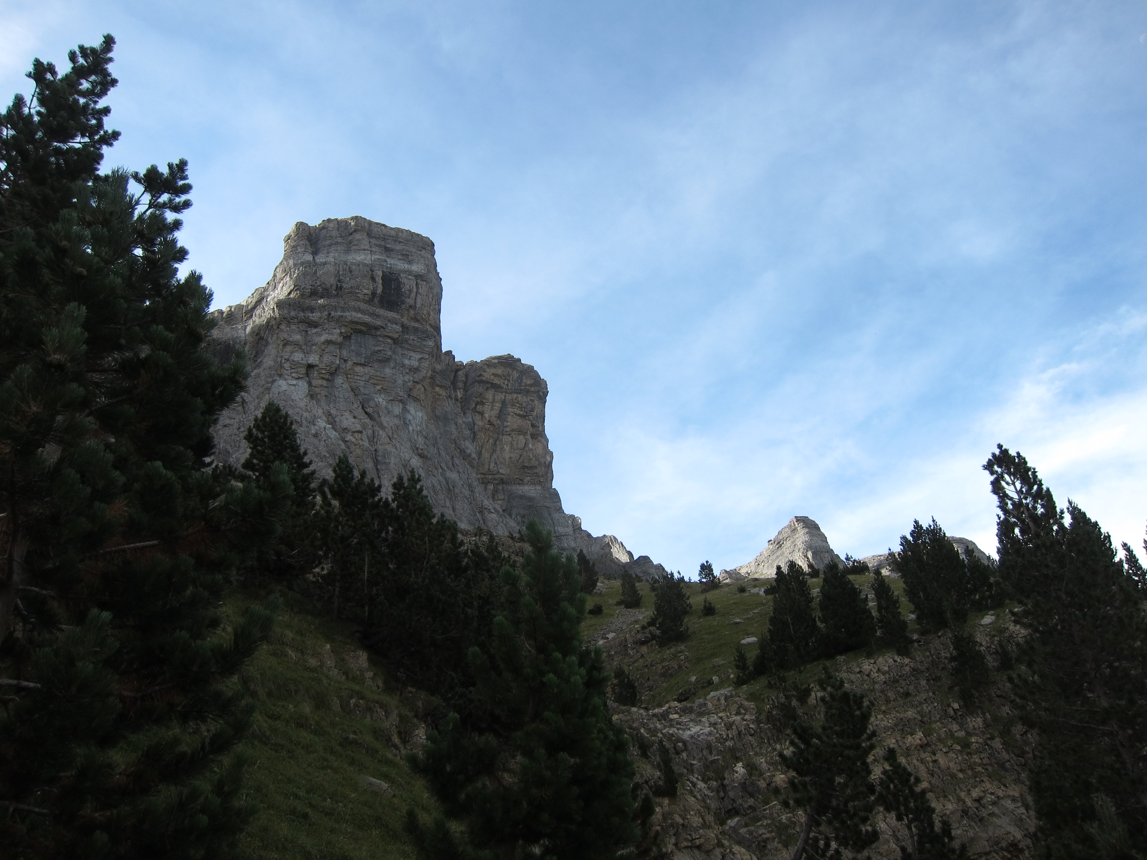
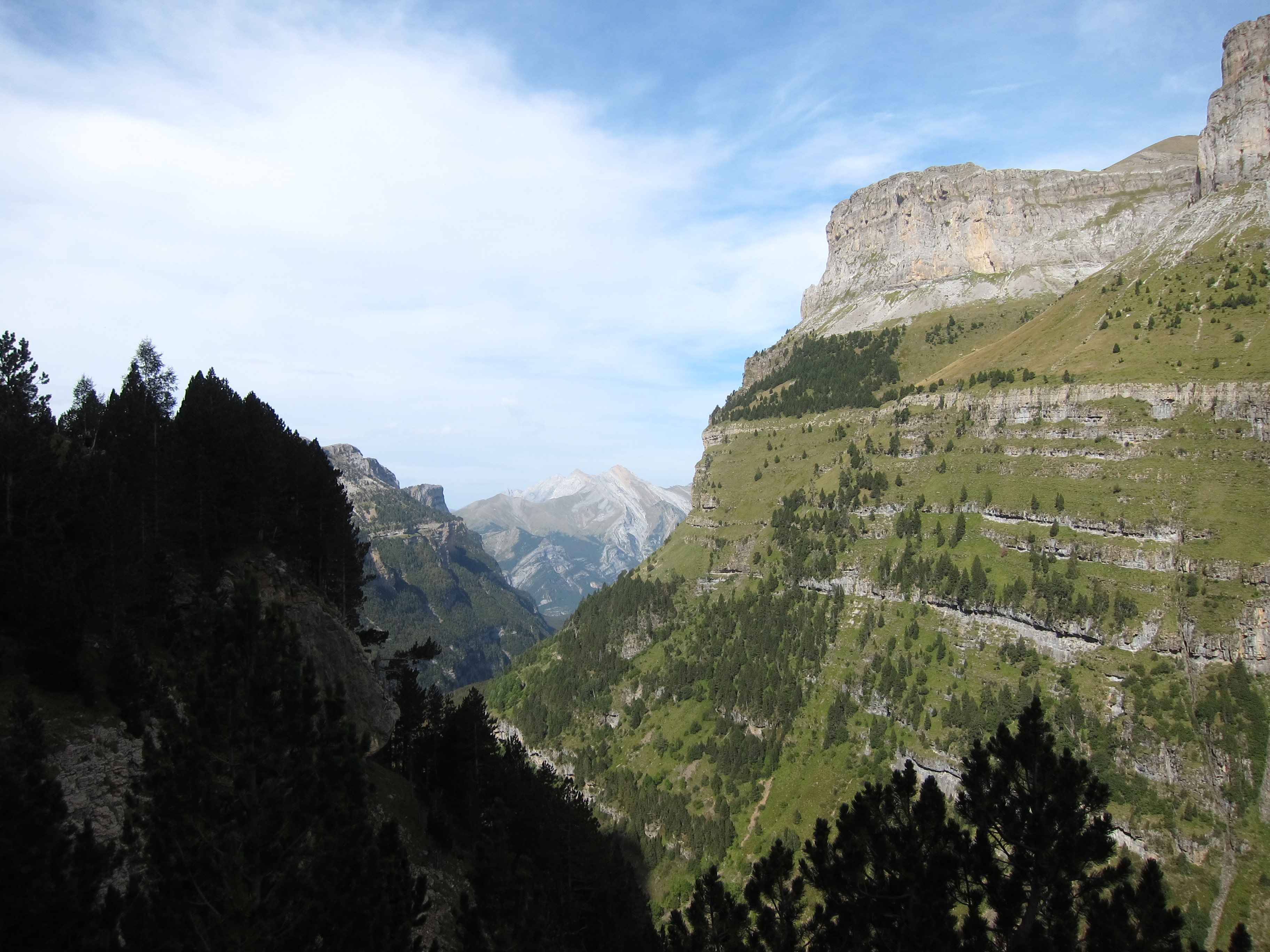
The Ordesa Canyon, just south of the high and sheer wall that divides France and Spain in the central Pyrenees, is walkers' heaven, a 15km (or so) long, extraordinarily evenly proportioned glacial gouge running pretty well straight for much of its length through the prevailing limestone, in place 1,000m deep and lined on both sides with huge and dramatic cliffs. It truly is a majestic and inspiring sight, from all angles.
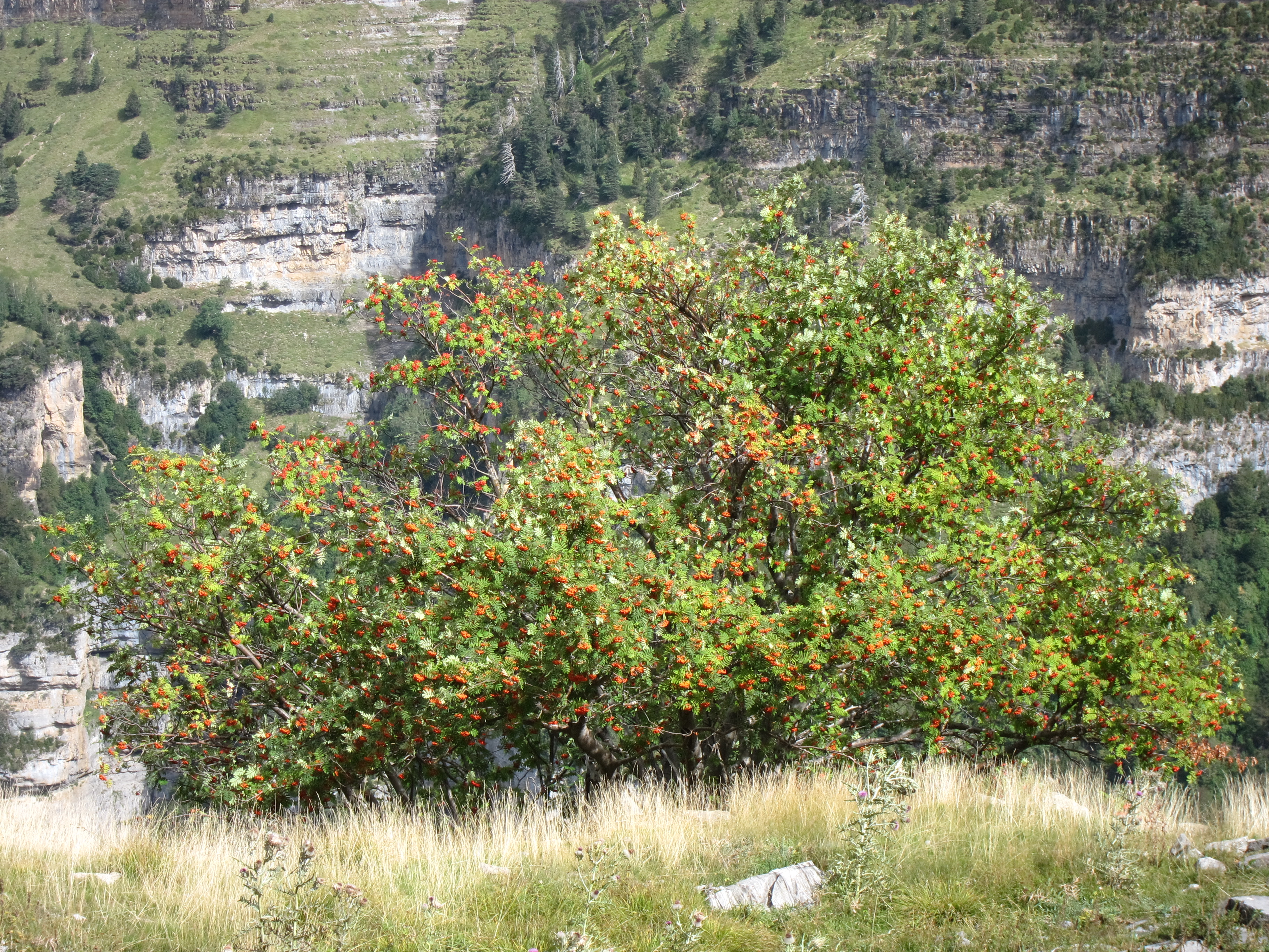
Whereas the highlands behind its rims are sparse semi-desert, the interior of the canyon is a very different world, a lusher mix of grassland at its top end and pine forests (lonely little people struggling with the elements higher up, statelier citizens further down) carpeted with ravishing vegetation and interspersed with lovely mixed deciduous woodland, which becomes predominant further down. Wildlife includes sorrios (chamois) and 31 other mammals species as well as a huge selection of birds.
The canyon is undoubtedly one of the Pyrenees' finest walking areas. You can make a combination of routes over several days of you want.
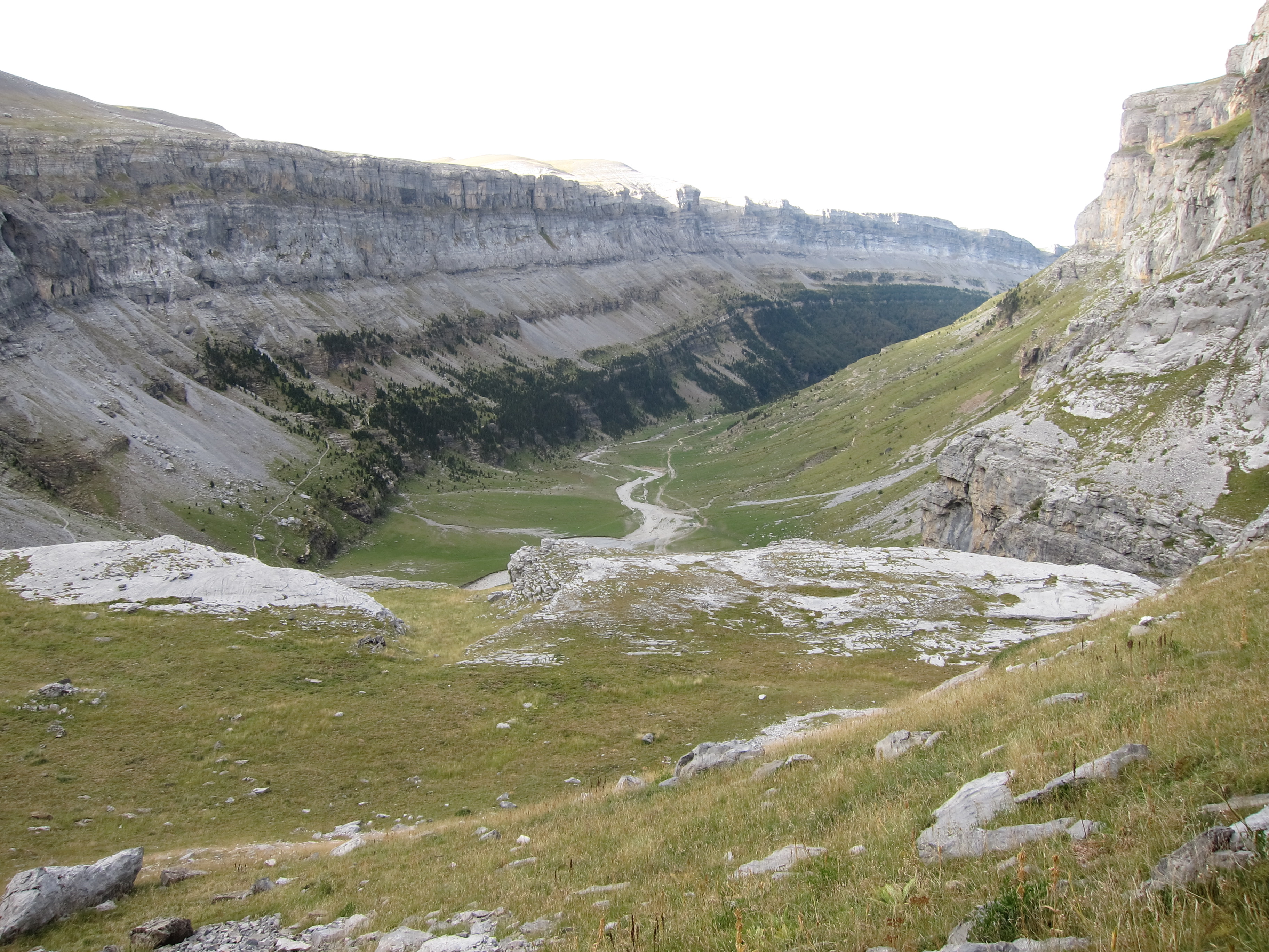
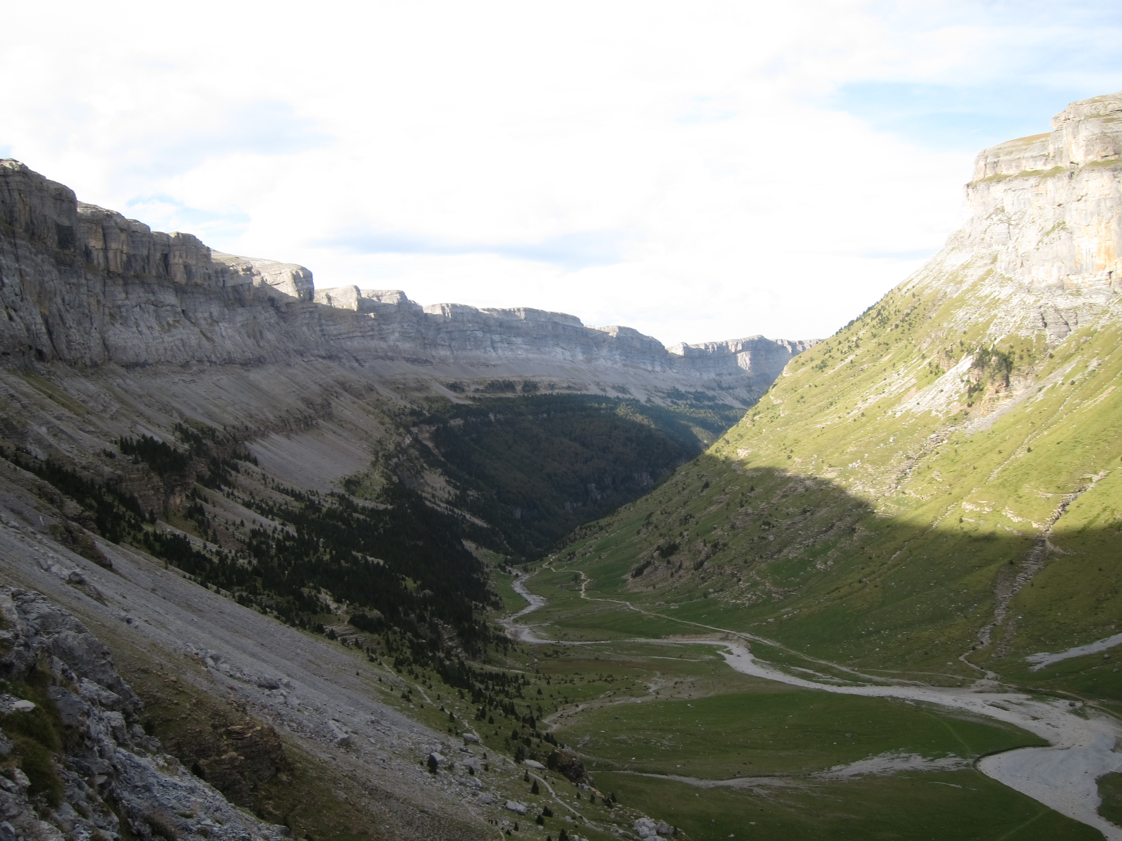
- a fine trail (a section of the great GR11 route) follows the length of the canyon bottom, right up to the great waterfall at its head. This is lovely and easyish walking, and is getting on for 8 km one way from the la Pradera carpark inside the canyon. From the waterfall it is around 2km (and some step climbing up the canyon wall) on to the Refugio de Goriz.
- the greatest walk must, though, be the Faja de Pelay, which follows an extraordinary balcony in the upper cliffs for some 8 km from the head of the canyon to the incredible viewpoint around two-thirds of the way down, when a steep, 600m ascent/descent must be made to/from the valley floor. Spectacular, dramatic, magnificent, thrilling, awe-inspiring: those overused words really do apply here.
- a more challenging cliff walk is the Faja de los Canarellos, which winds (in places giddily) around the central northern cliffs.
www.hikepyrenees.co.uk describes the Faja de Racon and Faja de las Flores thus:
"Faja Racon (11 km, 580m ascent, 5-6 hours): This path under the northern cliffs is overlooked by many visitors. You really get close to the cliffs walking directly underneath them and get an idea of the scale of the valley. There's a lovely contrast between the bare rock of the cliffs on your left and the lush green woods sloping away to your right. There's a good chance of spotting sarrios on this route as well as lammergeier.
Faja de las Flores (16 km, 1150m ascent, 9-10 hours): A spectacular path a kilometre high on the northern cliffs needing a very good head for heights. A steep path ascends over a thousand metres passing two sets of "clavijas" (iron pitons) on the way. At first there looks no place for a path but as you get closer the eroded band shows itself and you can see it winding its way along the cliff face. At only a metre or so wide with a 400 metre sheer drop to your right at all times, this is not a route for the faint hearted. The traditional descent passes across a cliff face by using an extremely scary set of chains and pitons. Those that don't fancy this can turn round and head back down the way they came. A superb hike."
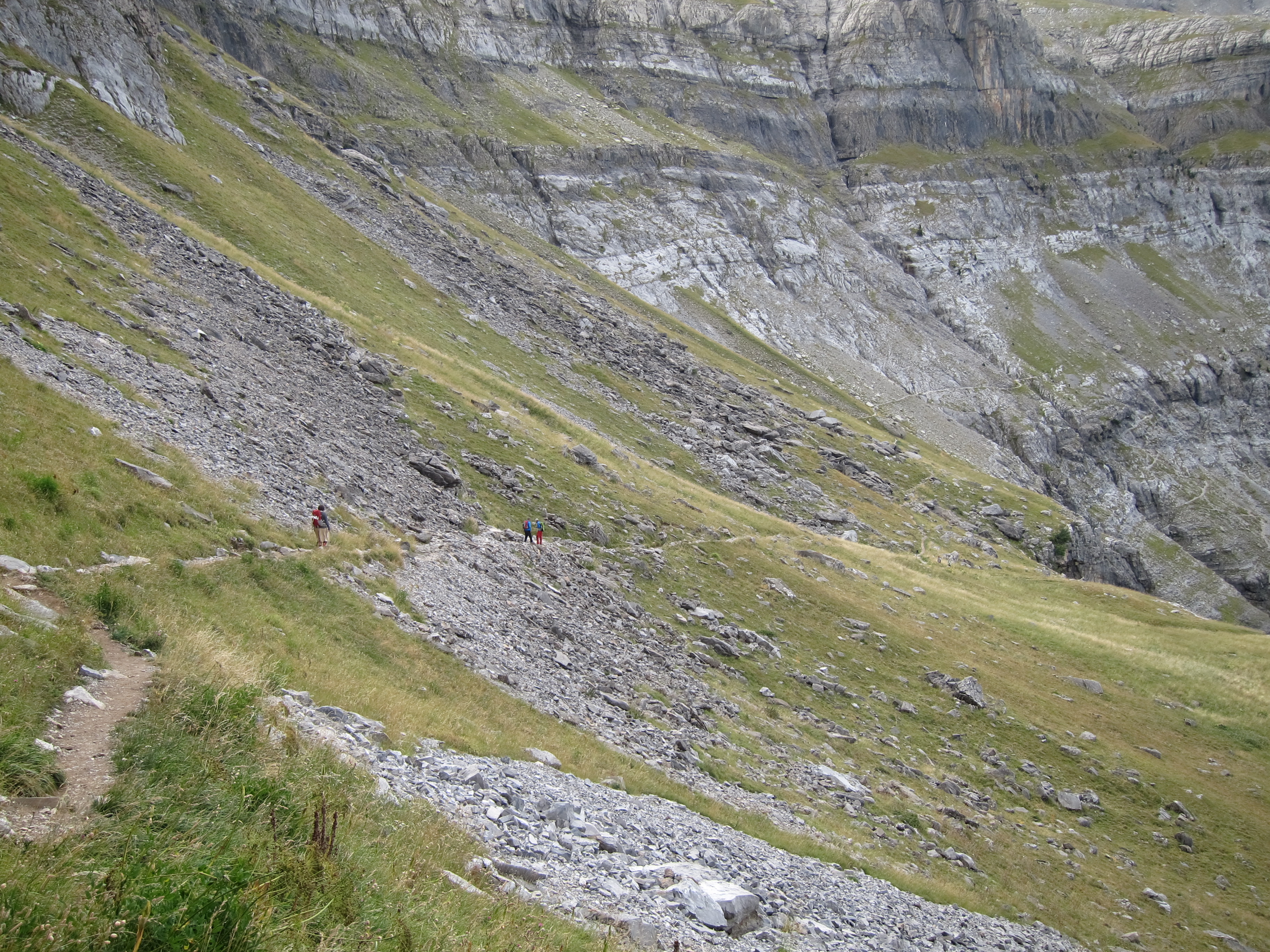
- there are superb walks along both rims. The northern options are a long way from civilization and are best accessed after a night in the Rifugio de Goriz - but are varied and empty. A climb or circuit round 2,769m Punta Tobacor high above the north rim looks particularly appealing. The relatively flat southern rim's routes are manifold, with views back across the canyon to the high peaks of the border ridge, and can be accessed from Goriz or from high roadheads at Fanlo and Nerin, or for the masochists from much lower near Torla. The Pico de Enmedio (at 2,133m), with five different approaches, is a natural target.
There is endless choice about what else you could do. A lot of walking can be fitted in in the Ordesa/Monte Perdido region, and you can of course head on to France to make the Gavarnie/OrdesaCircuit, one of our Top 100 walks. You could spend one or more happy days walking from the Goriz refugio, perhaps climbing the tough but magnificent Mont Perdu/Monte Perdido, the second-highest peak in the entire range, or teetering on the north or south rims as mentioned above.
***************
Be ready or rain at any time, although you will be unlucky not to get mainly gorgeous clear days in summer and early Autumn. Severe Summer thunderstorms are a regular feature which require immediate descent away from maximum exposed areas, and summer is often very hot. Snow lies late, with the high range only really clear by mid July.
Parts of the Canyon heave with tourists in high summer, and many day walks are busy at that time. So, come prepared to tolerate.
You can base yourself at or near the pleasant Torla to the south of the canyon?s bottom. In the high ground, accommodation comes down to the refuges and some camping - although they get busy (Goriz is said to be the busiest in the Pyrenees), so book well ahead if coming in the popular months. Camping is restricted to over 2,100 m and by the refuges.
Mention must be made of one particular guidebook, Cicerone?s Walks and Climbs in the Pyrenees which you should not approach this area without.
SEE OUR SPANISH PYRENEES PAGE FOR PRACTICAL AND GENERAL INFORMATION AND MORE PHOTOS.
Other accounts: share your experiences
Your comments on this walk, your experiences and suggestions, and your photos are very welcome. Where appropriate, you will be credited for your contribution.

Safety and problems: All walks have inherent risks and potential problems, and many of the walks featured on this website involve significant risks, dangers and problems. Problems of any sort can arise on any walk. This website does not purport to identify any (or all) actual or potential risks, dangers and problems that may relate to any particular walk.
Any person who is considering undertaking this walk should do careful research and make their own assessment of the risks, dangers and possible problems involved. They should also go to “Important information” for further important information.

Anyone planning an expedition to this place should see further important information about this walk.
Responsible travel matters, a lot. How you travel will make a real difference - for better or worse. PLEASE consider this when making plans. Read more
Contents
Other great walks in Spain
-
Via de la Plata (Seville to Santiago)
-
Andalucia, Cabo de Gata
-
Andalucia, Camino del Rey
-
Canary Islands, El Golfo, El Hierro
-
Canary Islands: Gran Canaria, Altavista Ridge
-
Canary Islands: Gran Canaria, Cruz Grande to the Nieves Ridge
-
Canary Islands: Gran Canaria, Inagua
-
Canary Islands: Gran Canaria, Pico de las Nieves
-
Canary Islands: Gran Canaria, Roque Nublo
-
Canary Islands: La Palma, Barranco de Herradura
-
Canary Islands: La Palma, Caldeira de Taburiente
-
Canary Islands: La Palma, La Palma
-
Canary Islands: La Palma, Los Tilos
-
Canary Islands: La Palma, Route of the Volcanoes
-
Canary Islands: La Palma, Ruta de la Cresteria
-
Canary Islands: Lanzarote, Above Teguise
-
Canary Islands: Lanzarote, Caldera Blanca
-
Canary Islands: Lanzarote, Femes area
-
Canary Islands: Lanzarote, Isla Graciosa
-
Canary Islands: Lanzarote, La Geria; Montana Tinasoria
-
Canary Islands: Lanzarote, Lanzarote
-
Canary Islands: Lanzarote, Los Helechos and West of Maguez
-
Canary Islands: Lanzarote, Maguez Area
-
Canary Islands: Lanzarote, Montana Corona
-
Canary Islands: Lanzarote, Risco cliffs
-
Canary Islands: Lanzarote, Termesana Route
-
Canary Islands: Lanzarote, Valleys West of Haria
-
Canary Islands: Tenerife, Anaga Peninsula
-
Canary Islands: Tenerife, El Portillo down into La Orotava
-
Canary Islands: Tenerife, El Teide and Pico Viejo
-
Canary Islands: Tenerife, Guajara
-
Canary Islands: Tenerife, La Orotava
-
Canary Islands: Tenerife, Las Canadas and El Tiede
-
Canary Islands: Tenerife, Roques de Garcia
-
Canary Islands: Tenerife, Samara
-
Canary Islands: Tenerife, Tenerife
-
Catalonia, Catalan Hills
-
Central, Sierra de Madrid
-
Galicia, Camino dos Faros
-
Mallorca, Tramuntana Traverse
-
NW, Galicia, O Cebreiro
-
NW, Galicia, O Vello Lugo Agrario
-
NW, Picos de Europa, Aliva Circuit
-
NW, Picos de Europa, Cares Gorge (Garganta del Cares)
-
NW, Picos de Europa, Jermoso Traverse
-
NW, Picos de Europa, Monfechu
-
NW, Picos de Europa, Valle del Dudje
-
NW, The Camino, Camino del Norte (Camino de Santiago alternative route)
-
NW, The Camino, Camino Frances (Camino de Santiago)
-
Picos de Europa, Lago de la Ercina
-
South-east, Montserrat
RESEARCH ESSENTIALS
Information and review
Finding flights, organising travel
Car hire
Accommodation
- Booking.com
 Search and book the best places to stay
 -
TripAdvisor
Equipment & Clothing
Books and Maps
- Amazon
- Maps and guides from Maps Worldwide
- Cicerone � explore the world�s best collection of walking books
Holidays and Activities

MAGAZINE

Walking with Trees: the Kumano Kōdō Kōhechi - Stephen Barber's account and photos of one of Japan's great pilgrimage trails. March 2021
RESPONSIBLE TRAVEL
Responsible travel matters, a lot. How you travel will make a real difference - for better or worse. PLEASE consider this when making plans. Read more