


Greater Caucasus Mountains


Key information: Greater Caucasus Mountains 
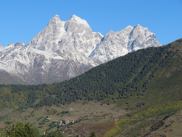
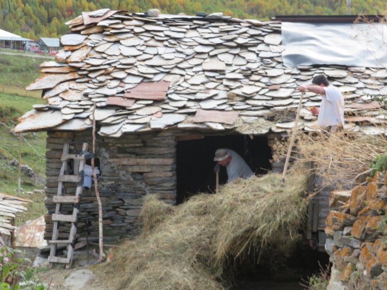
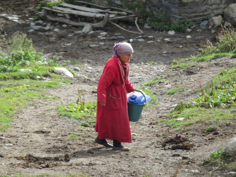
- The Greater Caucasus, Georgia’s highest mountains at the meeting-point of continents, are rich in landscape – and in culture and history.
- Exceptional walking in magnificent surroundings – vast icy spires above flowery meadows above lovely forests.
Walkopedia rating
- Walkopedia rating94
- Beauty34
- Natural interest17
- Human interest10
- Charisma33
- Negative points0
- Total rating94
Vital Statistics
- Length: Your choice
- Maximum Altitude: Around 3,500m?
- Level of Difficulty: Variable

WALK SUMMARY
The Caucasus Mountains run for some 1,100km, from the Russian Black Sea coast in the north-west, to Azerbaijan in the east and Armenia in the south. The Greater Caucasus to the north form the border between Russia and Georgia for most of their length and are separated from the Lesser Caucasus to the south by the plains of central Georgia. There is a gaping hole in the middle of the Georgian Great Caucasus, which is South Ossetia, a separatist area supported by Russia and which is (as of 2019) de facto Russian territory.
See our Georgia page for more information on the country.
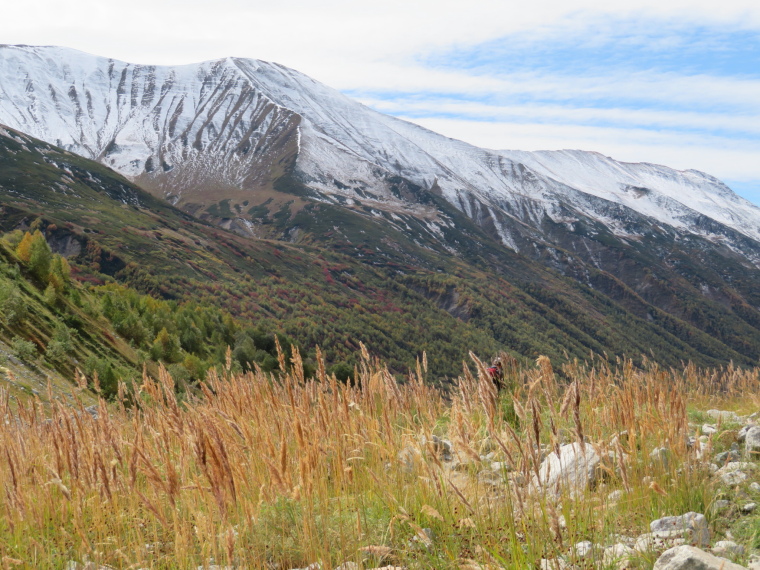
The Caucasus are extraordinarily beautiful, with an entrancing combination of high, grassy, flower-heaven pastures with huge peaks, spires and cliffs, and glaciers and meltingly beautiful lakes. Forests in the middle and lower reaches. On the whole you don’t come here for the wildlife, which is under severe pressure as a result of hunting and deforestation, but boar, deer and two species of ibex (mountain goats) do exist in the Caucasus, as do a reasonable selection of bird life, including black grouse, various raptors, and various migrants.
There are endless great walks here, from short explorations to multi-dayers. Higher and longer walks into the wilderness will require you to camp, but ponies and equipment can be hired in most of the main centres. There are also guesthouses dotted around the main areas, so you have plenty of less arduous options.
(The following walks are listed east to west.)
Lagodekhi Park, in the far east: the country’s oldest reserve teems with wildlife in its ancent forests. Huge views above the treeline. The Black Lake, high among the grassy slopes and rocky ridges, at 2,800m, is the best walk in the region. A wonderful 3 day trek. (Recommended by www.caucasus-trekking.com)
Tusheti (far north-east): still marvellous and remote despite growing visitor numbers. Some of the Caucasus’ very best scenery. There is only one high 4WD road in. Accessible late May to mid October. Main village – Omalo.
Longer walks
Omalo to Shatili (in Khevsureti) via the 3,413m Atsunta pass. One of the Caucasus’ great walks. 4 to 5 days/70km between the ancient centres of two Caucasus regions. A beautiful and fascinating trek (both naturally and in human terms) across this high pass in wild mountains.
Borbalo Pass: another crossing between Tusheti and Khevsureti, south of the Atsunta route. Cross a high ridge, spending at least two days on the high ground. 5 days/77km.
Circuit over the Nakaicho Pass from Omalo: This trek takes you up Tusheti’s northern Pirikiti Alazani valley to Parsma; then south over the tough Nakaicho Pass (2,900m) into the southern Gomtsari (Tushetis) Alazani valley to return to Omalo. 4-5 days.
Day walks: shorter walks include:
Between the valley-villages of Omalo, Shenako and Diklo.
To stunningly sited Oreti Lake in high grassy folds of the mountains south of Omalo.
Gonta Ridge: one of the Caucasus’ finest day walks follows this wonderful ridge between the two Alazani valleys, with huge views over them both and northwards to the highest border mountains. A long day.
Khevsureti (north-east): stunning landscape, ancient tower-littered villages, few people. May to November access only. The main (and classic fortified) village is Shatili; the pristine old village of Mutso has to have one of the most dramatic positions in Georgia. Great walks include:
Fantastic long walks linking Tusheti (see above).
Roshka, in the west, has a gorgeous walk to the extravagantly lovely Abudelauri Lakes. 4 hrs up to the highest lake. Also on the route over the Chaukhi Pass to/from Juta in Khevi (see below), one of the Caucasus’ great walks.
Shatali to Juta (in Khevi) via the Isirtghele Pass. 4 days said, to be very difficult. Up near the high border ridge.
The superb and remote day walk northwards down the Chanchakhi Gorge to Mutso.
Khevi (east of South Ossetia, north of Tbilisi), up the historic Georgian Military Highway, which links Tbilisi and the Georgian heartlands with Russia via a major pass. One of Georgia’s two best known walking areas, and its most accessible one.
Kazbegi: a region as well as a town in the high range just south of the border mountains. Centred on the Tergi river valley and dominated by the icy heights of 5,033m Mt Kazbek, a vast extinct volcano. Great walks include:
To the Gergeti Glacier: A fascinating and thrilling walk up a superb ridge above a dramatic gorge, towards the high glacier below mighty 5,033m Mt Kazbek. 22km, 8hrs or so. One of the Caucasus’ finest day walks.
The Truso Valley runs westwards off the upper Tergi valley, hard up against the South Ossetia border and leading right up to the high Russian border ridge. You can simply walk up the valley, which is fascinating and beautiful in its own right. As long or short as you want, as long as you have transport.
Keli Plateau: a bare if exceptionally beautiful once-volcanic plateau including features such as old lava flows and ex-volcanoes. Trek over two high (3,400m) but stunning passes to reach the region and beautiful Kelitsadi Lake. Access from the Truso Valley. A demanding 3 day/37km tour.
See our Khevi page for more.
Around Juta, up a long and rough road east of the Georgian Military Highway.
Juta to Roshka in Khevsureti via the Chaukhi (Abudelauri) Pass: a superb trek up a perfect grassy valley, via a lake, then across this high pass in wild, beautiful landscape: fascinating both naturally and in human terms. 3 days, up to 3,430m.
Or walk up the flower strewn-valley to the lake and on to the foot of Mt Chaukhi near Juta for a superb day walk.
Tetu Peak (3,210m) – a superb day walk.
See our Khevi page for more.
Off the Georgian Military Highway–around Gudaur: several walks here, including:
Khada Valley (often called Khada Gorge). Wonderful expanse of steep green slopes bristling with towers, all below high, craggy ridges. And a fascinating and thrilling walk up to the ancient Fire Cross Beacon Tower on a high ridge.
Lomisa Chapel: A steep climb to this C9 chapel perched high on the ridge which forms the border with break-away South Ossetia.
See our Khevi page for more.
Racha Area (west of South Ossetia): the Racha range sits just west of (and runs into) South Ossetia, and east of Svaneti. The region of Racha includes the major Rioni valley to the north, and the mountains north of that. Racha is little visited, and south of the highest Caucasus mountains, but it has some marvellous walking nonetheless. Great walks include:
Buba Glacier: climb through forest to emerge into high pasture with exceptional views of the high, icy peaks above and around. The Buba glacier is concealed beneath a thick carpet of rock in its lower reaches, morphing into high icy glamour between its surrounding peaks. A demanding 1,100m or so climb to a viewpoint at 2,534m. 17km/8hrs return. (Recommended by the excellent www.caucasus-trekking.com)
Udziro Glacier. Delightful 2 day hike to a lovely high lakelet in gorgeous mountain scenery. 1,800m(ish) of ascent/descent and the lake is at 2,800m (you cross a 3,000m+ pass), so a demanding walk. Good camping by the lake.
Walking between Racha and Svaneti.
Svaneti region (north-west): said to be Georgia’s wildest and remotest area (although its core sites get coach-loads), boasting staggeringly beautiful landscapes and riddled with ancient villages and towers. Upper (Zemo) Svaneti, with Mestia at its heart, is one of Georgia’s two best-known walking areas, with a host of great walks of all shapes and sizes. Lower (Kvemo) Svaneti is still superb, although south of the highest Caucasus mountains.
Day walks or less: there are numerous superb shorter walks, including:
Viewpoint east of Mestia: an upliftingly beautiful shorter walk to a viewpoint on the hillside east of Mestia.
Upper Mestia river valley to the base of the Chalaati glacier, 1.5 hrs or so. A stunner of a shorter walk, grandest scenery.
Above Ushguli: a gentle climb up a long, gorgeous valley to a glacier falling off Shkhara, Georgia’s highest mountain at 5,201m (stated heights vary!), in its ridge of rock and ice. Explore remarkable Ushguli to the east of Mestia, with its bristling towers that make this landscape so unique on the way. One of the Caucasus’ finest walks.
Becho valley: the upper Dolra valley, west of Mestia, leads up to one of the most dramatic valley-heads in the whole Caucasus range.
Guli Pass walk from Mazeri in the western Becho valley to Mestia across the glorious but high (2,961m) Guli Pass, with its amazing views of the sharp spike of famous Mt Ushba. Also approachable from Mestia.
Latpari Pass: this is a long day walk from famous Ushguli east of Mestia, southwards across the 2,963m Latpari Pass to Chvelpi in Lower Svaneti. Superb high landscape and breathtaking views north to the high Caucasus ridge.
Mhkeri Church: this ancient church sits on a hill near the mass of 4,000m Layla. Huge and astounding views of the surrounding mountains.
Mestia to Tsvirmi: a 6hr walk eastward across the high Zuruldi Massif, with outstanding views around some of the Caucasus’ greatest peaks.
Koruldi Lakes: walk to gorgeous tarns on the high slopes due north of Mestia. Vast views up the Mestia valley to the wild spires and glaciers of the border ridge.
For more details on these walks see our Svaneti page.
Multi-dayers
Mestia to Ushguli: a fabulous 4 day, 58km hike through glorious scenery, village-to-village so tents are not required, but book ahead in high season. Strenuous in places. These are amazing villages so you will get deep into Georgia’s history and culture. Said to be Georgia’s most popular longer hike.
Svaneti eastward to Racha: between Zeskho and Ghebi. 3 or 4 days, 39km. Crosses two high passes, in really remote country, so is a demanding hike. An outstanding route even by Caucasus standards.
To Tobavarchkhili Lake, in the superb Egrisi range in the south-west of Svaneti. A long and demanding trek in wild, remote landscape way off regular trekking routes at its upper end. Return the way you came or head on northwards over another high pass and through magical landscape to reach Khaishi on the Mestia road.
For more details on these walks, see our Svaneti page.
Great linking walks
You can make endless connecting walks from region to region. The king of these is the Trans Caucasian Trail. Many people walk the great routes between Tusheti and Khevsureti, or between Khevi (often from Juta) and Roshka in Khevsureti, then on eastward over the Barbalo and Tsubrovana passes to Ardoti – or, indeed, one more day on across the Khadotani Pass to Mutso.
______________________________
This can be demanding walking in remote mountains with uncertain weather, where altitude can be an issue. Come fully prepared.
Special thanks to Jozef Antala (a new hero to the walking world!), who created the superb www.caucasus-trekking.com, which has an excellent selection of treks, as well as a mass of valuable information. See their excellent overview trekking map at http://www.caucasus-trekking.com/maps.
We want to give you more! Please help us by recommending your best walks, making suggestions and sending photos! Thank you!
WILLIAM MACKESY'S ACCOUNT
of this walk
Walk 1 - Hillsides of Towers, Fire Cross Tower, Khada Valley
We're off! After a day and a half of city and driving, boots are on, packs shouldered and we're marching up a dirt road up a very pretty valley east of the Georgian Military Highway, that exotically named route.
This valley is a green-skinned hedgehog bristling with slender little towers, each hillside bearing at least one of them, sitting incongruously alone in its meadow: you wonder at the point of them, and their cost-to-resources ratio. There must have been one per extended family,.....
READ MOREOther accounts: share your experiences
Your comments on this walk, your experiences and suggestions, and your photos are very welcome. Where appropriate, you will be credited for your contribution.

We have a lot of helpful practical information and tips about this walk, covering everything from the best books and maps, to timing and weather, geting there, possible problems, whether you need a guide and where to find them, and useful websites. This section is only open to members.
Membership is FREE AND JOINING TAKES 30 SECONDS. To login or sign up click here
Safety and problems: All walks have inherent risks and potential problems, and many of the walks featured on this website involve significant risks, dangers and problems. Problems of any sort can arise on any walk. This website does not purport to identify any (or all) actual or potential risks, dangers and problems that may relate to any particular walk.
Any person who is considering undertaking this walk should do careful research and make their own assessment of the risks, dangers and possible problems involved. They should also go to “Important information” for further important information.
Anyone planning an expedition to this place should see further important information about this walk.
Safety and problems: All walks have inherent risks and potential problems, and many of the walks featured on this website involve significant risks, dangers and problems. Problems of any sort can arise on any walk. This website does not purport to identify any (or all) actual or potential risks, dangers and problems that may relate to any particular walk.
Any person who is considering undertaking this walk should do careful research and make their own assessment of the risks, dangers and possible problems involved. They should also go to “Important information” for further important information.

OTHER ACCOUNTS
share your experiences
Add your experiences, suggestions and photos. We would be delighted to receive your writing and ideas (which will be attributed appropriately where published).
Anyone planning an expedition to this place should see further important information about this walk.

Responsible travel matters, a lot. How you travel will make a real difference - for better or worse. PLEASE consider this when making plans. Read more
Other great walks in Georgia
-
Gt Caucasus, Around Gudauri, Khada Valley and Fire Cross Tower
-
Gt Caucasus, Around Gudauri, To Lomisa Chapel
-
Gt Caucasus, Khevi, Khevi, Kazbegi and the Military Highway
-
Gt Caucasus, Khevi, To Gergeti Glacier
-
Gt Caucasus, Khevi, Truso Valley, Keli Plateau
-
Gt Caucasus, Svaneti, Above Ushguli
-
Gt Caucasus, Svaneti, Becho Valley
-
Gt Caucasus, Svaneti, East above Mestia
-
Gt Caucasus, Svaneti, Guli Pass
-
Gt Caucasus, Svaneti, Koruldi Lakes
-
Gt Caucasus, Svaneti, Mestia to Ushguli
-
Gt Caucasus, Svaneti, Svaneti Region
-
Gt Caucasus, Svaneti, To Tobavarchkhili Lake
-
Gt Caucasus, Tusheti and Khevsureti, Atsunta Pass (Tusheti to Khevsureti)
-
Gt Caucasus, Tusheti and Khevsureti, Gonta Ridge
-
Gt Caucasus, Tusheti and Khevsureti, Tusheti and Khevsureti
RESEARCH ESSENTIALS
Information and review
Finding flights, organising travel
Car hire
Accommodation
- Booking.com
 Search and book the best places to stay
 -
TripAdvisor
Equipment & Clothing
Books and Maps
- Amazon
- Maps and guides from Maps Worldwide
- Cicerone � explore the world�s best collection of walking books
Holidays and Activities

MAGAZINE

Walking with Trees: the Kumano Kōdō Kōhechi - Stephen Barber's account and photos of one of Japan's great pilgrimage trails. March 2021
RESPONSIBLE TRAVEL
Responsible travel matters, a lot. How you travel will make a real difference - for better or worse. PLEASE consider this when making plans. Read more