Contents
The Aiguilles Rouges, French Alps
Icon: Kanchenjunga
Walkopedia favourite: Tash Rabat
Community Article: Wollo Highlands, Ethiopia
New on Walkopedia Website
 

Welcome to the Winter 2014/15 edition of Walkopedia Magazine.

We hope you find it inspiring and entertaining.

Let us know what you think and do tell a friend by forwarding this magazine to them.

If you would like to receive future editions register here (it is easy).

Coming up soon:

  • India�s outstanding Singalila Ridge
  • The UK’s magical Yorkshire Dales

See our magazine archive.

Get a regular dose of happiness: follow us on Facebook.

Walkopedia Home Page


Aiguilles Rouges

Mt Blanc from Aiguilles Rouges, early light

In walking terms, the Aiguilles Rouges punch above their weight. This relatively small range lies across the deep Chamonix valley to the north of Mont Blanc. With dramatic serrated ridges and wonderful scenery of their own, they also command outstanding views of the huge Mont Blanc massif with its glaciers and wildly broken ridges surmounted by serene permanent snows. They gained their name (the ‘red needles’) from the glowing red of their iron-infused granite spires in the morning light.

The Aiguilles are riddled with beautiful tarns, including the famous Lac Blanc at the foot of Belvedere. Typical alpine vegetation alongside orchids and other less common flora, and surprisingly un-shy ibex (especially around Lac Blanc), further enhance the excitement. An Aiguilles Rouges Nature Reserve was created in 1972.

Unsurprisingly, tourists flock here in peak season, and the slopes above Chamonix are packed in high summer. For the more adventurous, in search of an antidote to the busy slopes on southern face of the range, the areas further from Chamonix offer more isolated exploration.

Mt Blanc from Lac Blanc, early light

Longer Walks:

  • Tour of the Aiguilles Rouges (4-6 days): The best way to discover the area, is a balanced combination of what the range has to offer, on the unofficial �Tour of the Aiguilles Rouges�. There are a number of ways of creating a circuit through the best of the Aiguilles. Our version is described in detail here.
  • Tour du Pays du Mt Blanc, a shorter but varied �official� circuit around the popular south-eastern slopes and remote interior.
  • Mont Buet (2 days): the Cicerone says �I defy anyone to find a walk more beautiful than that from The Vieux Emosson to the summit of Mont Buet in good weather�.

 Mt Blanc from Lac Blanc, sunset
Mt Blanc from Lac Blanc, sunset

South-eastern slopes: The slopes above Chamonix contain a plethora of superb walks � albeit crowded at popular times of year � and showcase the Aiguilles� remarkable Mont Blanc views. You can combine the options to include a night or two up high:

  • Lac Blanc: a 3-4hr trail to a beautiful pair of milky blue lakes with classic views across to the vast Mer de Glace glacier and the soaring Aiguille Vert sections of the Mont Blanc massif. This is the Aiguilles� best known walk, and commensurately crowded in high season.
  • The Grand Balcon Sud, a long and very satisfactory contour-hugging trail which, because it is also part of the Tour du Mont Blanc and Tour du Pays du Mont Blanc trails, can get overcrowded. See our Lac Blanc and Southern Aiguilles Rouges Traverses page for more options and detail.
Ibex at Lac Blanc
Ibex at Lac Blanc

Mt Blanc, across Chamonix valley

6. Mt Blanc from Lac Blanc 3
Mt Blanc from Lac Blanc

Walkopedia rating: 88.5 - Top 100

More information on this walk


TOP

Icon: Kanchenjunga from the Singalila Ridge

Kanchenjunga from Sandakphu, evening light


Walkopedia rating: 89 – Top 100
More information on this walk


TOP


GOT SOME PICS OR A STORY THAT ARE SO GOOD THEY MUST BE SHARED?

Let us know – email us at info@walkopedia.net. They may get published!


Get a regular dose of happiness: follow us on Facebook.


TOP

Walking Human History: Tash Rabat pass on the old Silk Road, Kyrgyzstan

Up the valley across the caravanserai

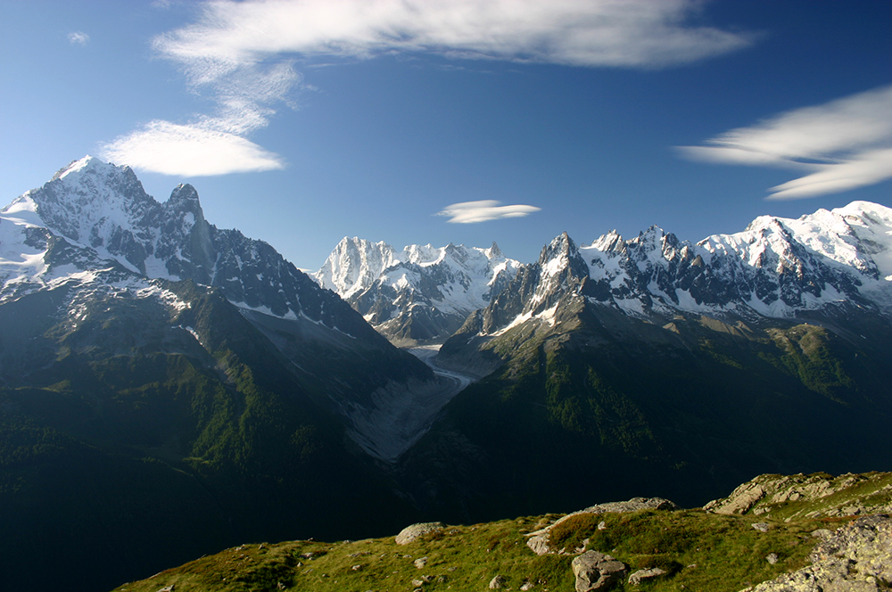
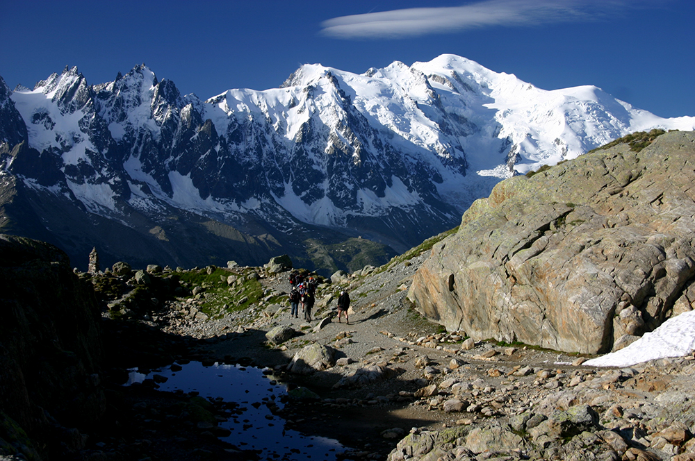
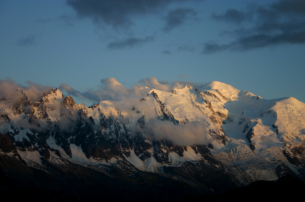
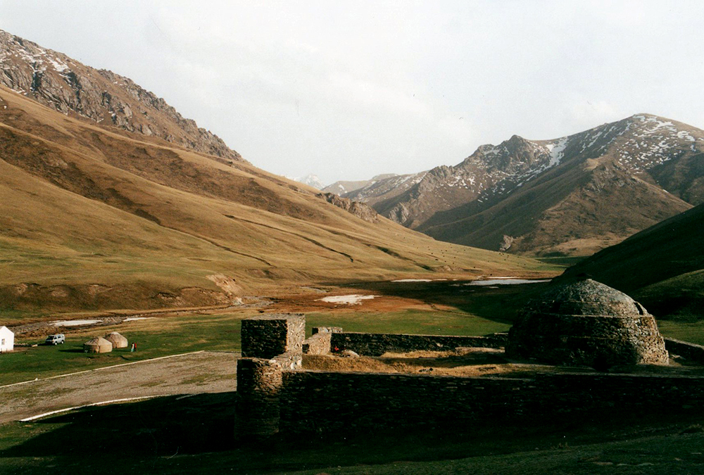
High in the wilds of the Tianshan mountains, a traveller on the Silk Road would have reached with relief an extraordinary shelter in this dangerous landscape: the fortified caravanserai of Tash Rabat.

This ancient complex lies in the former Soviet Republic of Kyrgyzstan, near the border with the western Chinese province of Xinjiang, where the Tianshan, the romantically named Mountains of Heaven, approach their junction with the Pamirs.

The Silk Road was a braid of routes which linked China with distant and semi-mythical Indian and Mediterranean regions, and the Roman and Byzantine empires in particular. The passable routes changed over the centuries, as powers rose and fell, and areas descended into lawlessness or re-emerged with the advent of some new strongman.

From the Chinese heartlands, the route followed the narrow Hexi corridor between the twin terrors of the Tibetan plateau and the Gobi desert, splitting to skirt the the vast and fearsome Taklamakan desert to the north and south, pausing at oases along the way. The Tash Rabat pass lies north of the Kashgar oasis at the far western corner of the Talamakan.

Across the valley from the caravanserai

The Silk Road was arguably the greatest ever cultural highway, along which ideas and technologies as well as goods passed from as far apart as the Roman and Chinese worlds. Buddhism reached China along the Road, evidenced by the arrival in Chinese art of concepts and styles which were alien to its earlier culture. There were also Nestorian Christian, Muslim, even Jewish communities in Tang dynasty Xian.

The oasis-cities of the central deserts were as a result cosmopolitan, wealthy and home to a creative stew of ideas; but they were always at risk from invaders and the relentless sands, and the cultures of the Taklamakan in particular vanished, with few traces and little record, until rediscovered by the archaeologists of the late 19th and early 20th Centuries.

Trade was, of course, the lifeblood of the Silk Road. The product that defined the route was silk made in China, which guarded the secrets of its manufacture for centuries. It was so prized in imperial Rome that it was profitable to transport it overland in huge caravans, passing through a chain of middlemen as it was transloaded onto new animals for each stage of the enormous journey.

Other products traded along the Road included precious metals, woven materials, ceramics, spices, camels, horses and other animals. Another great, and terrible, catalyst for change travelled westward along the Silk Road: the Black Death, the underminer of feudalism in Europe.

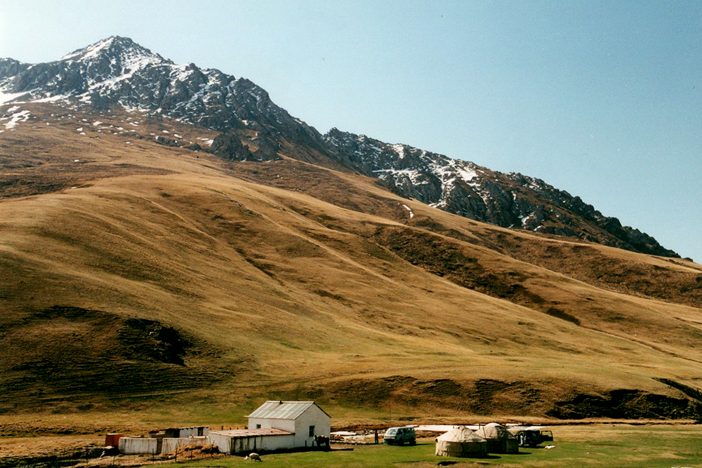
Any trade route needs servicing, and the wealth and risk represented by the caravans spawned an extensive network of caravanserais, many of them still surviving, which provided accommodation, food and protection for merchants, their servants and animals and their precious cargoes. Tash Rabat is a classic of its kind, and extraordinarily evocative.

Tash Rabat squats, square and brooding, protected by massive walls and corner towers, partly embedded into the hillside behind. It is accessible only through a single strong gateway. Inside, a series of linking chambers around an impressive, domed, central hall provided accommodation for merchants, their retainers and their animals. It is a gloomy and faintly sinister place, lit only by small openings in the roof. It must have felt utterly remote � but secure once behind its massive door. History lies heavy here, and the people who sheltered here, and their lives and fears, and easily and vividly imaginable.

Toward the high pass

Herdsman
Herdsman

Following the old caravan route up the valley to the high pass is what you are there for, although you could walk here for days.

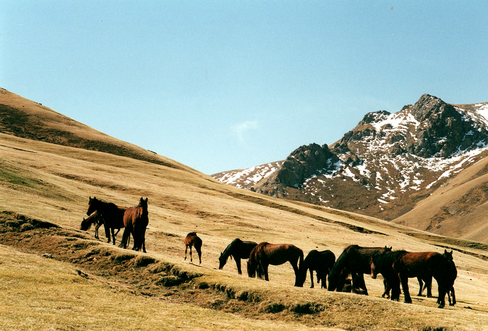
You will set off up the wide valley floor, perhaps passing herds of ponies or yak. Grassy slopes rise steeply on both sides until they end in crags and false ridgelines. This must have been uneasy country for the caravanners, each cleft possibly holding a raiding party. The valley narrows, and you start to climb. The stream divides into several sparkling branches which you cross and re-cross.

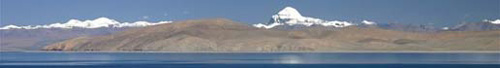
Around an insignificant-seeming bend, you are suddenly gazing into the impenetrable looking wall of the At-Bashy range, jagged crags over thick snowfields, looming majestically at the far end of the valley, where the stream divides in an aquatic T-junction. The route turns up the steep hillside to the right and, after a steep slog, emerges high above the stream, across it to your left the peaks, cliffs and snows of the high Tianshan.

You eventually drop to the stream and labour up above a valley which climbs into the heart of the At-Bashy. You can almost hear the curses of the Silk Road drovers as they thrashed their unwilling ponies up the final steep traverse across a high hillside to the col. Here you gain the grand view south across lake Chatyr-Kul toward the final line of smaller peaks and then the wild plunge down to the Tarim Basin and the Taklemakan Desert. The pass is saddle-shaped and windy and cold, even in Summer, so you will soon retreat to the lee of a rook for a rest and snack.

Ponies on early grass

Walkopedia rating: 86
More information on this walk


TOP

Community Article: Wollo Highlands, Ethiopia

Walkopedia friend Max Duncan trekked in the timeless highlands of Wollo, near Ethiopia’s ancient Christian pilgrimage site, Lalibela, in late 2013. These are his pictures, and some of his thoughts.

This three-night walk takes you across a plateau of dry farming and grazing land, returning repeatedly to escarpments offering breathtaking views of the valleys below. Eucalyptus - an imported species - and juniper dominate, but ancient olive and acacia trees also provide welcome shade. The altitude of around 2,500 metres means it’s never hot and even chilly at night.

You get a fascinating look into rural life essentially unchanged for centuries. Children herd sheep, donkeys and cattle as parents stack hay beside round ‘tukul’ houses of packed earth. There is no electricity or machinery, even plastic is rare.

The trek is part of a scheme providing income for villagers who guide and cater for visitors in simple but clean lodges owned by the community. Each lodge sits right on the edge of the escarpment, so upon arrival travellers can enjoy a spectacular sunset view, freshly-pounded Ethiopian coffee in hand.

Gelada baboons, unique to Ethiopia, clamber in large packs across cliffs. Vultures, augur buzzards and occasionally giant lammergeyers soar above.

This easy walk might disappoint serious climbers, but the flatness and the availability of horses make it perfect for families with older or younger members. Altogether there are 11 community lodges, the highest around 4,000m, so longer, more challenging walks are possible.

Canyons
Canyons
Escarpment edge, sunset


Big View
Big View

Walkopedia rating: 94 - Top 100
More information on this walk


Enjoy our magazines? Help us, free to you…

Walkopedia is time-consuming and expensive to produce.

Help us (at no cost to you) by buying your travel and other books on Amazon via the links on our website.

And by forwarding this magazine to friends and telling people about Walkopedia.

And by liking us on facebook.

Research Essentials

Here are some essential tools for your travel research:

Finding flights, organising travel
Accommodation
Books and Maps

Subscribe for Walkopedia Magazine

Our magazine is free, and easy to register for.

Subscribe now


TOP

New on Walkopedia website:

Walk of the month:
  Latest walk:
Galapagos Islands   Breche de Roland Pyrenees, France/Spain
 

Hike through a lunar landscape of craters, old lava flows, pumice and tuff, on this remarkable volcanic archipelago.

Experience the diverse, and often beautiful, wildlife of the "little world within itself", which was to inspire a significant swathe of Darwin's work on evolutionary theory: slow moving giant tortoises, the brightly coloured blue-footed boobies, marine iguanas, fur seals and, of course, Darwin's finches.

Read More ...


A spectacular ascent to the famous Breche de Roland, a breach in the wall of cliffs that forms the national border high above the even more famous Cirque de Gavarnie.

This is the finest day walk in the Gavarnie area, indeed one of the finest in the whole Pyrenees.

This can be tough walking in high, remote mountains. Come prepared.

Read More ...

Number of walks featured in Walkopedia: over 750.


Walkopedia use the magnificent
Cicerone guidebooks

www.cicerone.co.uk


Get a regular dose of happiness: follow us on Facebook.


We welcome your recommendations and comments. Give us your thoughts.
Enjoyed this magazine? Forward it to a friend
If you would like to receive future editions of our Walkopedia Magazine, register here (it is easy).

About Walkopedia Magazine:

Editors: William and Alexandra Mackesy.
Contact us at walkopedia@googlemail.com.
We hope you enjoy our magazine. But we don't want to waste your time, so
feel free to unsubscribe at any time. See Walkopedia's privacy policy.

All photographs © William Mackesy, save where otherwise stated.
All other materials © Walkopedia Ltd 2014, save where otherwise attributed.


Can't read this email properly?